Retracing Donn Fendler: A Journey from Katahdin to the East Branch
Day One
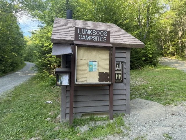
I had to work fairly late on Friday, and Josie still had plenty to do before we could get on the road. By the time we headed north toward Lunksoos Camp to drop off my truck, darkness had already settled over Katahdin Woods and Waters National Monument.
The dirt roads were quiet and dusty. When we arrived at Lunksoos, there wasn’t another person or vehicle in sight. After unloading my gear and leaving the truck behind, I climbed back into the van and we headed south along the Grindstone Road toward Millinocket. We spent the night at the Penobscot Outdoor Center in one of their canvas tents. By the time we finally crawled into bed, it was after midnight. With the alarm set for 4:00 a.m. so we could be at Togue Pond Gate before it opened, we ended up with less than four hours of sleep.
We were both exhausted.
We arrived at the gate around 4:30 a.m. and were about the tenth vehicle in line. Since I hadn’t been able to secure a Hunt Trail parking reservation, I knew we needed to be there early to have any chance of getting a spot.
At 6:00 a.m. the gate finally opened, and I spoke with a very kind ranger named Pam. We got talking about my plans, and I explained the trip I was about to begin. She was immediately intrigued and mentioned that she had actually met Donn Fendler years ago.
I can’t say enough good things about the staff at Baxter State Park. Every single person I interacted with was supportive of this trip and genuinely wanted to help make it happen.
As we drove farther into the park, another unexpected encounter followed.
A man standing along the road flagged us down. He had traveled from Washington State for his first visit to Baxter, but his camper van was too large to enter the park. He was hoping to hitch a ride with anyone willing to take him to a trailhead. He didn’t particularly care which one, as long as he could climb Katahdin that day.
We offered him a ride.
During the drive he introduced himself as Henry.
I couldn’t help but smile at the coincidence. Henry was also the name of Donn Fendler’s guide on the day Donn disappeared in 1939. This time, however, our roles were reversed. I found myself acting as Henry’s guide, recommending that he ascend the Hunt Trail, traverse Knife Edge, and descend the Helon Taylor Trail to Roaring Brook.
By about 7:10 a.m., after saying goodbye to Josie, I finally started up the Hunt Trail.
The lack of sleep was catching up with me, but I settled into a steady rhythm and kept climbing. I had started with only one liter of water, planning to refill at Thoreau Spring while crossing the Tableland.
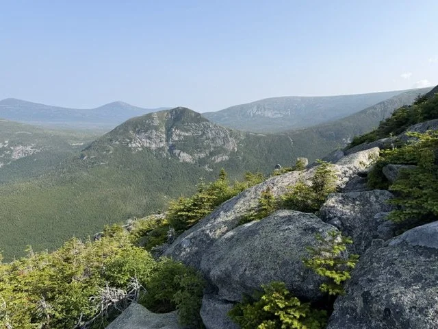
Just before 11:00 a.m., I reached Baxter Peak.
No matter where I go in Maine, it seems I always run into someone I know.
This time it was Elise, one of the teenagers who had volunteered on my trail crew years ago when I worked for the Appalachian Mountain Club. She now works for Katahdin Woods and Waters National Monument after previously working for Baxter State Park, and she was volunteering that day as an alpine steward on the summit.
Her job was to educate hikers about staying on the designated trails and protecting the fragile alpine vegetation. The summit gets incredibly busy, and having someone there to protect that unique environment is invaluable.
We spent a few minutes catching up before I continued on my way.
From Baxter Peak I descended toward Saddle Trail before turning onto the Northwest Basin Trail. As I walked, I found myself thinking constantly about Donn and what he must have experienced on this mountain.
Seeing the terrain firsthand gave me an entirely new appreciation for just how rugged Katahdin truly is.
Even on an established trail, the footing is slow and awkward. Endless boulders of every imaginable size, steep ledges, thick puckerbrush, and countless obstacles demand your attention every step of the way.
Then I imagined a frightened twelve-year-old boy, alone in cold rain and dense fog, forcing his way through that same landscape without a trail.
The distances Donn covered under those conditions are nothing short of remarkable.
After a quick snack at the Saddle Trail junction, I stopped again at Caribou Spring to refill my water bottle. No matter how much I drank, I couldn’t seem to stay hydrated. Every bottle disappeared almost as quickly as I filled it, the water seemingly leaving my body as fast as I could replace it.
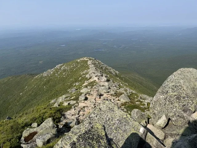
It’s an uncomfortable feeling, but one I’m familiar with after long days carrying a heavy pack through the mountains.
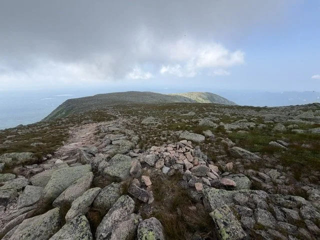
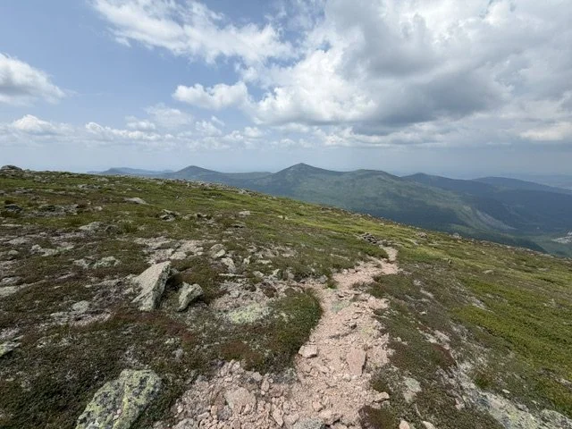
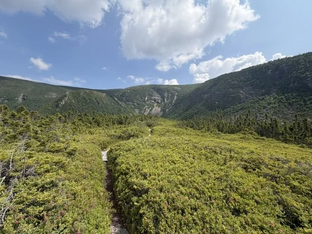
Beyond Caribou Spring, I crossed the Northwest Plateau.
It’s one of the most beautiful stretches of trail I’ve ever walked.
Small rocks and alpine vegetation spread across a vast open landscape, while the trail itself becomes an inviting ribbon of crushed stone that makes for wonderfully easy walking.
Then, almost without warning, the plateau ends.
The trail plunges steeply into the Northwest Basin toward Davis Pond and Lake Cowles.
The easy walking instantly gives way to slick granite slabs coated in algae, exposed tree roots polished smooth by years of runoff, and steep, awkward footing that demands complete concentration.
The Northwest Basin Trail clearly doesn’t receive nearly the traffic that Baxter’s more popular routes do.
By then, my knees were incredibly thankful for the trekking poles I had brought along. They absorbed much of the impact while helping me keep my footing on the slippery descent.
Donn described this part of the mountain as a maze of loose boulders and nearly impenetrable puckerbrush that slowed his progress to little more than a crawl.
Standing there, I understood exactly what he meant.
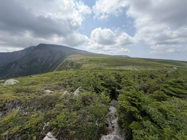
The upper elevations were choked with dense krummholz and puckerbrush. Farther down, thick spruce and fir crowded the mountainside before gradually giving way to a mixed forest of younger conifers and hardwoods.
As difficult as the trail itself was, I was grateful I wasn’t trying to force my way through that vegetation without one.
I’ll gladly take slippery rocks over crawling through puckerbrush.
When I finally reached Davis Pond, the afternoon heat had become intense. I sat beside the water for a few minutes before retreating into the shade of the lean-to.
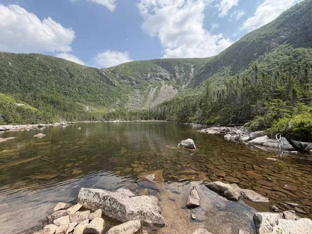
Lying on the wooden floor for ten or fifteen minutes felt wonderful.
The lack of sleep, mild dehydration, and inevitable calorie deficit were all catching up with me.
I honestly felt like I could have fallen asleep right there.
Instead, I packed up and continued toward Russell Pond.
I still had about five and a half miles remaining, but thankfully the terrain became much gentler after crossing the Wassataquoik Stream. From there, the trail paralleled the stream almost all the way to Russell Pond before the river eventually bends toward Ledge Falls, Inscription Rock, and Grand Falls.
My left knee, the one that’s given me trouble before, had begun to swell from the long descent. I was hungry and thirsty enough that I felt slightly nauseous.
Fortunately, I knew exactly what I needed.
Food.
Water.
Rest.
The mosquitoes and deer flies became relentless during those last miles. I carried both bug spray and a head net, but I avoid wearing the net unless things become truly unbearable.
The bug spray kept the mosquitoes mostly under control.
The deer flies, however, couldn’t have cared less.
They constantly buzzed around the back of my head, landing right where the adjustment strap meets the back of my hat. I lost count of how many I swatted away.
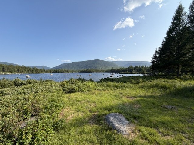
Russell Pond was new to me.
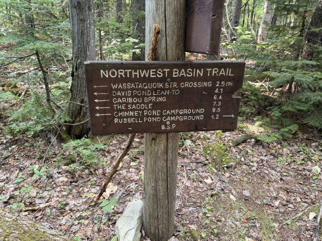
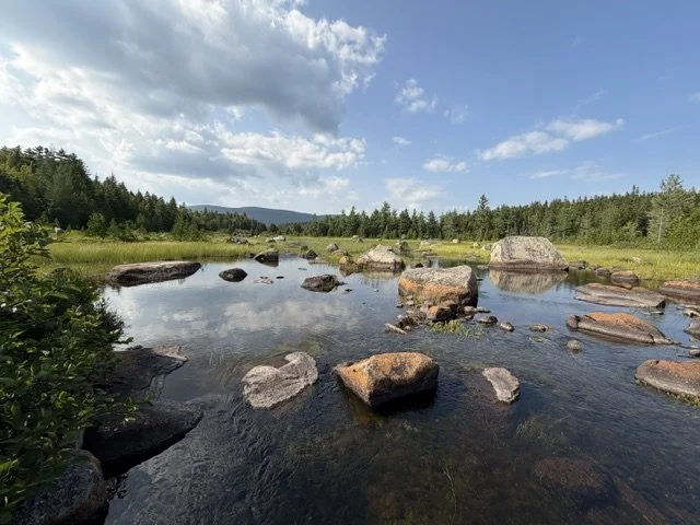
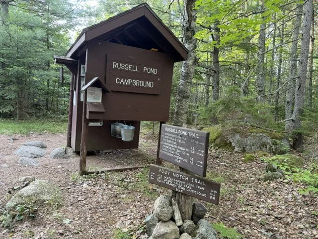
After passing the bunkhouse, a large information kiosk, and racks of paddles, life jackets, and rental canoes, I made my way through the spacious campground toward the ranger station.
That’s where I met the Ranger, Danielle.
As soon as I walked through the door, she looked at me and asked,
“Are you Wilford?”
I smiled and told her I was.
She had seen my Facebook post about the trip.
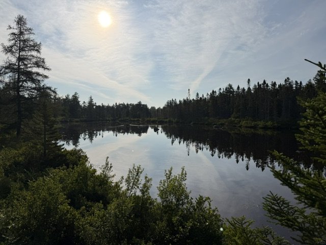
We spent five or ten minutes talking about my plans while she explained the campground and pointed me toward the best water source, making it clear that the warm, shallow pond itself wasn’t the place to collect drinking water.
She also asked a few questions to make sure I was prepared for what lay ahead.
I completely understood.
This wasn’t an ordinary backpacking trip.
The country beyond Grand Falls is among the most remote in Maine, and any rescue there would take considerable time and effort. I assured her I had plenty of navigation experience and understood exactly what I was getting into.
People often ask why I choose to do trips like this alone.
I understand the concern.
But what many people don’t realize is that solitude offers something impossible to experience when you’re constantly surrounded by conversation.
When you’re alone, your mind eventually quiets.
It wanders.
It imagines.
It reflects.
You begin to notice things you otherwise wouldn’t.
I love adventures with friends and family, and I wouldn’t trade those experiences for anything.
But they’re different.
When you’re with other people, your attention is naturally drawn outward. Conversation never stops for very long.
When you’re alone, your attention gradually turns inward.
I need both.
Danielle then informed me that I had actually reserved a tent site rather than a lean-to.
Since I hadn’t brought a tent, only my bivy sack, I wasn’t as keen on the idea after having expected a lean-to. Although I would have been fine to sleep on the ground in my bivy, she mentioned that the bunkhouse had plenty of room.
That ended up being a blessing.
It had a stainless steel countertop for cooking, secure food storage, and comfortable bunks I could lay out my inflatable pad on. I spread my gear across one bunk and slept on another. Although two other people had reservations that night, they never showed up. I had the entire bunkhouse to myself.
For dinner I boiled water for a freeze-dried chicken fettuccine Alfredo and added fresh chanterelle mushrooms I’d picked along the trail that afternoon.
After drinking what felt like endless amounts of water, I sat on the porch finishing my meal before finally crawling into bed.
These are the moments I treasure.
The simplicity of it all makes me genuinely happy.
In our modern lives we’ve solved countless inconveniences with technology, but in the process we’ve also created an entirely new set of problems.
Tonight, none of those problems mattered.
I was completely content with three basic needs:
Food.
Water.
Sleep.
Experiences like this make me wonder where we’re headed as a society. The endless information, constant stimulation, and technology we consume every day aren’t things humans evolved to handle. I suspect we’re only beginning to understand the effects they’re having on us.
Tomorrow, the real adventure begins.
At the end of the Grand Falls Trail, I’ll leave the established paths behind and enter the heart of the Wassataquoik drainage, following as closely as possible in the footsteps of a frightened twelve-year-old boy whose story has captivated me for years.
Day Two
I wish I could say I slept well, but I really slept poorly last night. The issue I always have when I’m backpacking is rarely my sleeping pad. It’s always the pillow. I can never seem to find a backpacking pillow that’s worth its weight. There’s nothing like a real pillow, and if I don’t have one, I toss and turn all night long. That’s just the reality of these trips.
Even so, I felt much more rested and energetic than I had yesterday morning after getting less than four hours of sleep, climbing Baxter Peak, and continuing nearly 14 miles to Russell Pond.
It didn’t matter anyway, because this was the part of the trip I had been looking forward to most. From here on, I would leave the established trails behind and begin the bushwhacking portion of the journey. Between Russell Pond and Wassataquoik Lean-To in Katahdin Woods and Waters National Monument, I would bushwhack approximately eight miles, followed by another two miles after crossing the Wassataquoik Stream and following the established trail from Orin Falls to the lean-to.
Donn Fendler likely didn’t cross anywhere near here or hike on the opposite side of the stream. I only did because I had to use designated campsites in both Baxter State Park and Katahdin Woods and Waters. This was simply the closest legal place to camp while staying as faithful as possible to Donn’s route.
I got up around 5:45 a.m. and started boiling water for coffee and breakfast. This morning’s menu was another freeze-dried meal of eggs, sausage, potatoes, peppers, and cheese. It was actually pretty good and definitely hit the spot.
As I waited for the water to boil, I packed up camp. I rolled up my sleeping pad, stuffed my sleeping bag into its compression sack, and packed my backpack like a game of Tetris, keeping the things I’d need most near the top and the items I wouldn’t need until evening at the bottom.
As I sat at the picnic table eating straight from the meal pouch with my extra-long handled spork, specially designed for these meals and an absolute game changer, I studied my map and thought about the day ahead.
By 6:45 a.m. I was on the Grand Falls Trail. I wanted an early start in case the bushwhack proved more challenging than I expected.
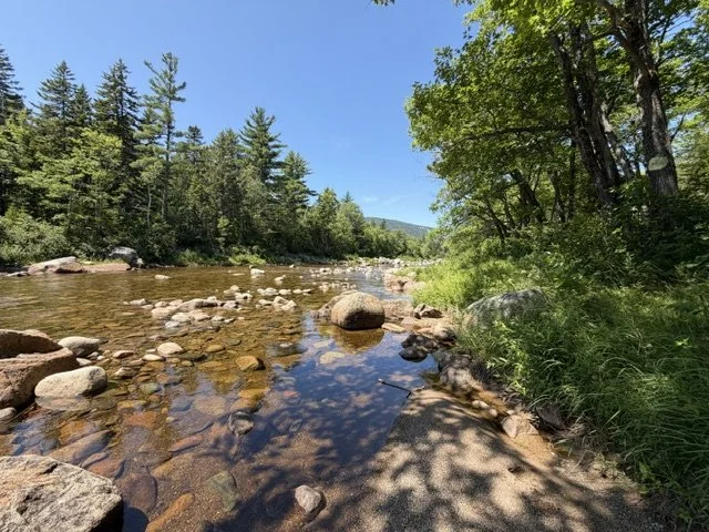
The Grand Falls Trail is another good example of a trail that sees very little traffic compared to other parts of Baxter State Park. The treadway is narrow, with blueberry bushes crowding the edges and patches of ferns that sometimes lean so far into the trail they nearly hide it altogether. Walking through in the early morning meant the dew soaked my legs within minutes.
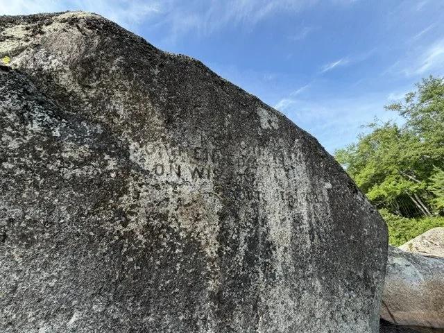
Eventually I reached Bell Pond and stopped at Inscription Rock, where the outlet of Bell Pond empties into the Wassataquoik Stream.
Though difficult to read after more than a century of weathering, the inscription says:
TRACEY AND LOVE COMMENCED
OPERATIONS ON WASSATAQUOIK
OCTOBER 16, 1883
The inscription marks what historians generally consider the beginning of intensive logging in this part of the valley.
I didn’t stay long before continuing toward Grand Falls.
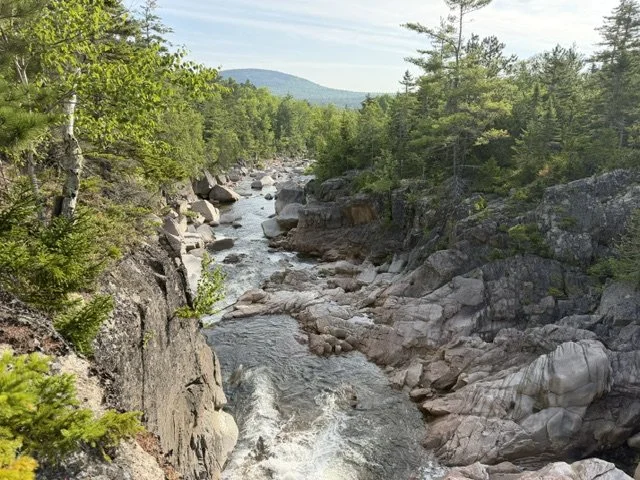
The approach isn’t especially strenuous, but the trail hugs the river beside what is essentially a gorge. A slip here could easily result in a dangerous, if not fatal, fall onto the massive boulders below while whitewater rushes between them.
It’s an incredibly scenic and remote place, and the trail ends abruptly. In fact, there’s a rock painted with the word “END” in blue, matching the trail blazes, just to make sure there’s no doubt you’ve reached the end of the maintained trail.
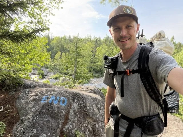
I sat there for a few minutes. Somewhere near this area, Donn encountered the first of two bears during his ordeal.
After drinking some water and eating a protein bar, I said to myself, “Well, here we go, I guess.”
There wasn’t an obvious place to begin the bushwhack. The landscape was littered with house-sized boulders, and the bank dropped steeply toward the stream. My best option seemed to be carefully climbing down to the water’s edge while using branches to steady myself.
Once alongside the stream, I picked my way between and beneath a couple of huge boulders before climbing back up the embankment where the ground finally leveled out. I pushed through the brush along the top of the bank, and after that the going became much more manageable.
Overall, the travel wasn’t terrible, although there were plenty of places where I had to zigzag around dense patches of growth or tangled masses of blowdowns.
After some time, I arrived at the area once known as Old City.
Old City was once the heart of the Wassataquoik logging operation. Established in the early 1880s by lumbermen Foster Tracey and Hugh Love, it served as a major logging camp and supply hub for crews working deep in the valley. The old tote road leading away from camp carried men, horses, and supplies through the wilderness long before Baxter State Park existed.
Though little remains today beyond scattered artifacts and the old roadbed itself, it was here that Donn Fendler unknowingly stepped onto a route that would eventually lead him out of the woods.
It was in this area that Donn found an abandoned cabin containing a can of coffee and another can of salt. He also found a piece of metal that he tried to use to make sparks.
I remember reading that he first struck the steel inside the dark cabin and thought it was producing plenty of sparks. When he took it outside and tried again, hoping to start a fire, it suddenly seemed much less effective. Of course, the sparks had only appeared brighter and more visible inside the darkness of the cabin. Once he stepped into the daylight, they were much harder to see.
As I looked around Old City, I could tell that people had lived and worked there long ago. The ground was unusually flat, and the open sightline beneath the trees seemed to extend much farther than anywhere else I had traveled that morning.
It was here that I stumbled onto the old tote road, just as Donn had in 1939.
Although the road had already been abandoned for decades by the time Donn reached it, he must have immediately understood that he had found something significant. The cabin, the old road, and the telephone wire strung alongside it were all evidence that people had once occupied this valley. Even though the forest had already begun reclaiming the land, these signs must have strengthened his hope that he was finally getting closer to civilization.
The nature of Donn’s journey changed at this point. He was still alone and far from safety, but now he had something made by people to follow.
As I left Old City and began walking the tote road, there was no question what I had found. I could clearly see the deep ruts left behind by horse-drawn wagons and sleds more than a century ago. In places, the raised roadbed was still quite pronounced, and rocks had been piled along the edges where the road passed through uneven terrain.
Every so often, I would lose it where dense vegetation had swallowed the corridor or where years of flooding had washed sections away. After zigzagging along the edge of the stream, however, I would usually pick it up again fairly quickly.
In some places, it almost felt like an established footpath. Generations of wildlife have likely continued using the old road as an easy route through the forest. The ground beneath my feet was noticeably hard and compacted. Even after all these years, the impact of the road remains visible.
Whenever I wandered off it, the ground quickly became softer, rougher, and less efficient to walk on. Staying on the old road was helping me maintain good progress as I traveled along the Wassataquoik.
Another strange coincidence happened while I was walking. As I passed through the same general area Donn reached on his sixth day in the woods, I heard an airplane flying overhead, just as he had.
Hearing an airplane today is hardly unusual, but the sound caught my attention immediately. It pulled me back into Donn’s story and made me wonder what it must have felt like for him to hear an aircraft somewhere above the valley. He may have believed that people were searching for him, while also knowing that he was still hidden beneath miles of forest.
It wasn’t long after that when one of the most incredible moments of my trip occurred.
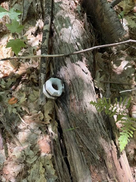
I found a section of the old telephone wire and one of the white ceramic insulators that had once been attached to the trees. It was nothing more than a short piece of wire and a single ceramic knob hanging from a dead branch, but I can’t express how happy it made me.
I had assumed that any remaining evidence of the telephone line would have fallen, rusted away, or become buried beneath the forest floor decades ago. The fact that I happened to notice this small surviving piece made me feel even more connected to Donn’s experience.
After taking a picture, I left the wire and insulator exactly where I had found them.
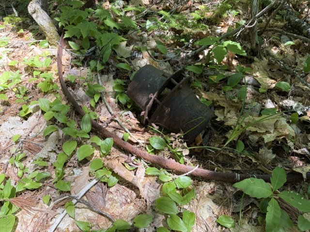
I also came across a couple of old galvanized buckets, both badly dented and partially rusted.
As exciting as it was to find these artifacts, there was another reality I had to contend with in those damp, swampy woods: the deer flies.
I had thought they were bad the previous day on my way to Russell Pond, but that was nothing compared to the offensive they mounted against me along the Wassataquoik.
They eventually became so relentless that I broke down and put on my head net. It offered some relief, but they would still land on the back of my head and bite through the net wherever it pressed tightly against my skin. Every so often, I had to pull out some excess netting above the strap of my hat to create enough space between the mesh and my head to keep them from biting me.
For whatever reason, they mostly ignored the exposed skin on the back of my neck. When they couldn’t reach my head, they went after the undersides of my arms and my biceps instead.
The flies certainly kept me moving. If I stopped for too long, more of them would gather and begin swarming me. Even while I walked, they followed closely behind until they finally landed and gave me an opportunity to swat them.
Even the ruthless deer flies couldn’t dampen my excitement when I came across what appeared to be the steel rim of an old wagon wheel, along with what may have been a double-sheave pulley.
A pulley like this could have been used to redirect cable or rope for logging equipment, hoists, or stationary machinery. Logging camps depended on all kinds of belt-driven and cable-driven equipment. I’m not completely certain of the identification, though. It may instead have been a belt pulley from an early stationary engine or sawmill.
By this point, I had entered the general area where Donn encountered his second bear and, two days later, found more abandoned cabins.
I didn’t see any bears, but I did come across some very fresh bear scat. It was full of elderberries, which are well in season right now. I also saw plenty of blueberries, although most of them appeared to be about another week away from prime picking.
I examined the scat closely and even broke apart part of it with a stick to get a better idea of what the bear had been eating.
In this area, and in several other places throughout the remainder of the day, I found large rocks that had recently been overturned. Some were heavy enough that only a fairly large animal could have moved them. I had no doubt that a black bear had been turning them over while searching for insects and other food.
Although I never saw one, I knew I was traveling through bear country and that they were likely not far away.
I’m not generally afraid of black bears. They usually want very little to do with people and are simply trying to survive like every other animal in the forest. The situation that does make me nervous is encountering a mother with cubs.
I experienced something like that while thru-hiking the Appalachian Trail, and I felt fortunate that I wasn’t charged or attacked.
That encounter happened down south, near the Appalachian Trail and Blue Ridge Parkway, where the bears were more accustomed to people and traffic. I sat at a picnic table eating lunch while a mother and her three cubs climbed an oak tree beside us, shook acorns from the branches, and then climbed back down to eat them. As long as I minded my own business, the mother didn’t appear concerned by my presence.
Encountering a mother bear in the North Maine Woods, one that may have had little or no contact with people, could potentially be a different experience.
Fortunately, the amount of noise I was making as I clawed my way through the woods and cursed at the deer flies was probably enough to warn any nearby wildlife well before I reached it.
Surprisingly, I was averaging around 1.5 miles per hour during the bushwhack along the old tote road.
As I followed it, I kept thinking about how this route should be preserved and maintained as a historical footpath connecting Baxter State Park with Katahdin Woods and Waters National Monument.
The corridor is rich in logging history and is also the likely route followed by Donn Fendler. Why wouldn’t we want other people to know about it and experience it for themselves?
If maintained, it could become one of the finest riverside walks in the region. The ruggedness and beauty of the Wassataquoik cannot be overstated. It is truly a gem.
I’m sure there are plenty of people who would rather see the valley remain exactly as it is, untouched and wild, allowing nature to continue reclaiming a place that was once at the center of a booming logging industry.
I understand that perspective, but I’m also convinced that preserving the route would help people better understand and remember the history of this valley and the incredibly tough men who once worked in these forests.
The Old City tote road was one of the earliest practical approaches to Katahdin from the east, although it was never built for mountain access. It was built for logging. Its later use as an approach to Katahdin was essentially a byproduct of the logging industry.
To me, that history further supports the idea of preserving it as an officially maintained historical trail.
Even during long days of slogging through the woods, time seems to pass much too quickly. I always feel as though there aren’t enough hours in the day to observe, explore, and investigate everything I would like to see.
At the same time, I still have to maintain a steady pace if I’m going to reach my destination before the end of the day.
Before I realized it, I had reached Orin Falls.
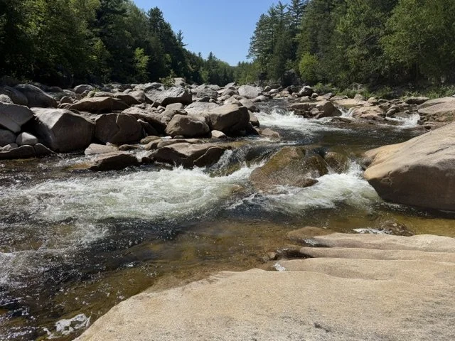
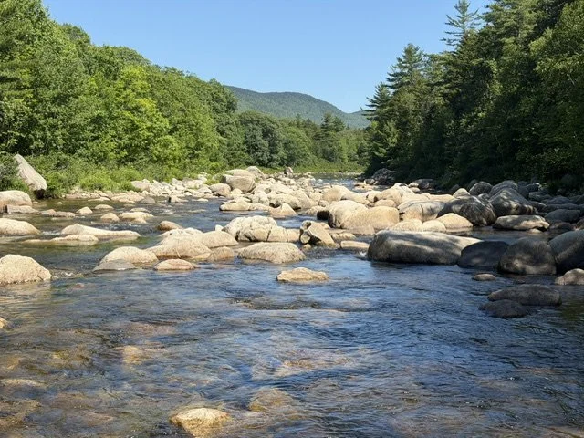
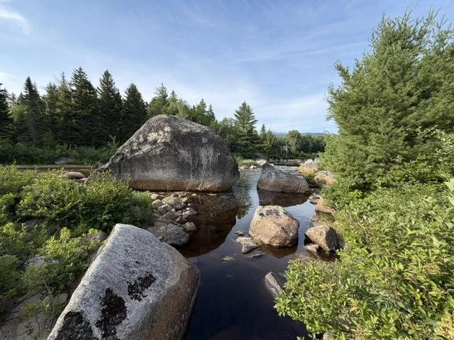
Orin Falls isn’t really a traditional waterfall so much as a long series of cascades, but it is wild and beautiful nonetheless.
This was where I needed to cross the Wassataquoik in order to reach Wassataquoik Lean-To.
It wasn’t an easy crossing.
Even under fairly modest water levels, the river was tricky to negotiate. Depth perception plays a major role when scouting a crossing. From a distance, the water often looks shallow enough to walk through without much trouble. Once you get closer, however, the situation can look completely different.
Some channels appeared deep enough to rise above my waist. Large, awkward boulders were hidden beneath the surface, and they were as slick as grease whenever I tried to step on them. Getting a leg trapped between two rocks in the rushing current could easily result in a serious injury.
I took my time and was extremely selective about where I crossed.
I eventually chose a spot a short distance downstream from Orin Falls. Even there, the crossing wasn’t easy, especially with the additional weight of my backpack.
Still, I made it safely to the other side without incident.
After crossing, I expected to find a hiking trail, specifically the Orin Falls Trail.
What I found instead was clearly an old gravel road that modern maps now label as a trail. At one time, it appears to have crossed several tributaries flowing into the Wassataquoik, but the bridges have either been removed or washed away.
What remains is an easy, open corridor leading directly to Wassataquoik Lean-To and eventually connecting with the existing road system inside Katahdin Woods and Waters National Monument.
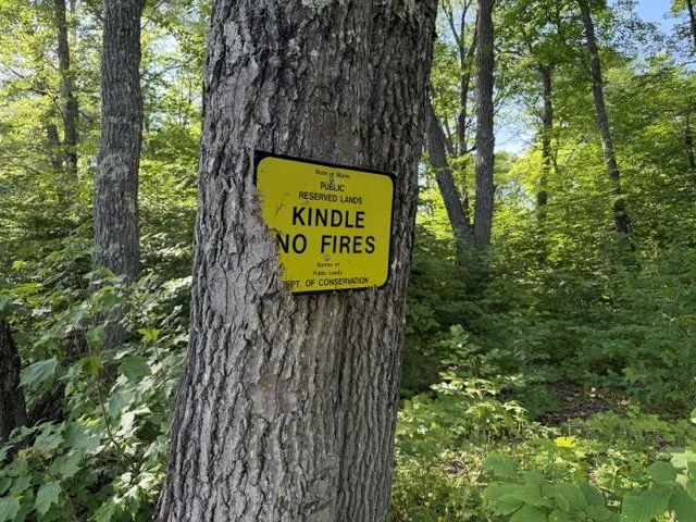
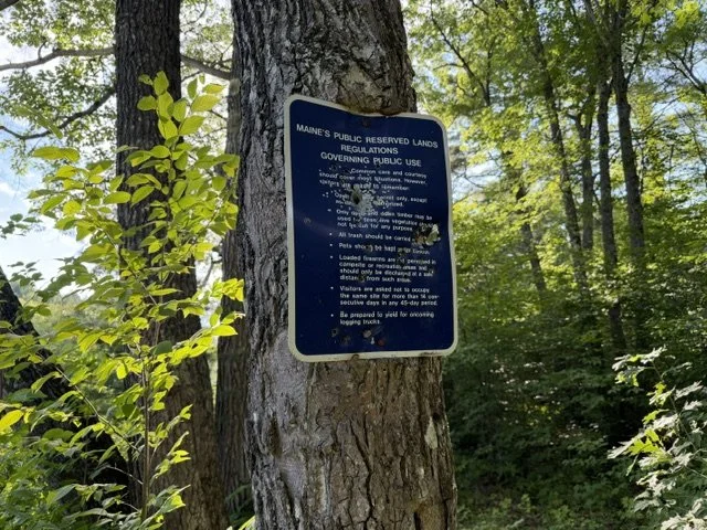
The walk from Orin Falls to the lean-to was a breeze compared to everything that had come before it. I made excellent time and arrived at around 3:00 p.m.
The site is essentially a lean-to beside a gravel road, although it had one of the best bear boxes I have ever seen. The shelter was in excellent condition, and the entire campsite looked nearly new.
Then I checked the time and wondered what the heck I was going to do for the next several hours before nightfall.
It didn’t take long for me to decide that I wanted to keep moving.
Physically, I was certainly tired enough to stop. Mentally, however, I wanted more. I wasn’t ready for the day to end.
By 3:15 p.m., I had already shouldered my pack and started walking again.
Not long after leaving the campsite, I forded the Wassataquoik once more. This crossing was as easy as could be, with gently flowing water that remained only shin-deep all the way across.
This section of trail is officially part of the International Appalachian Trail, although I wouldn’t remain on it for very long. I soon turned onto the Old Keep Path, which climbs over the low shoulder of Deasey Mountain.
I was surprised by how obvious the Old Keep Path remained.
In many places, it looked less like an abandoned trail and more like an old road, with raised embankments and a wide, clearly defined corridor through the forest. It was easy to imagine horses and wagons hauling supplies over the route more than a century ago.
For most of his journey through the valley, Donn likely remained close to the Wassataquoik Stream. Near its confluence with the East Branch, however, he may have joined this old tote-road system and followed what is now called the Old Keep Path during the final stretch toward the river and Lunksoos Camp.
As I followed the path, I never once lost the old roadbed. There were certainly sections of thick growth, but they were usually easy to walk around because more mature mixed forest bordered the corridor.
By this point, my energy and endurance were beginning to decline. I knew I only had several miles remaining before I reached the banks of the East Branch of the Penobscot River.
During those final hours, I felt more like a machine than a person.
I knew my objective, and I knew I needed to make it out that night. Once I left the Old Keep Path and took a direct bearing toward Lunksoos, there would be no suitable place to camp. The area was also a haven for mosquitoes. Remaining stationary for any length of time would have meant being eaten alive.
The stretch between the Old Keep Path and the East Branch was only about three-quarters of a mile, but it proved to be the grand finale of the day.
I trudged through beaver flowages, swamps, and fields of ostrich ferns that towered above my head. I was exhausted and covered in scratches from the branches I had pushed through throughout the day. My left knee was swollen, and every step was becoming painful.
At one point, I reached a marshy area covered by shallow water.
This was clearly active beaver territory. Beneath the surface was a thick layer of sediment and muck. Each time I placed a foot into the water, it sank six or eight inches and created a powerful suction. When I tried to pull my feet free, the mud threatened to take my water shoes with it.
I knew I couldn’t simply wade straight across.
Fortunately, I found a fallen tree that bridged the swamp. I carefully crossed the log, then grabbed onto the trunk of a standing tree on the far side and worked my way around it until I could reach solid ground.
The fallen tree appeared almost exactly where I needed it. Had I been forced to search in either direction for another crossing, it might have taken a considerable amount of time.
Once I cleared the swamp, I could see a large opening through the trees in the distance. I knew it had to be the corridor of the East Branch of the Penobscot River.
When I finally emerged onto the riverbank, I could see gear and several canoes across the water at Lunksoos Camp. There were also a couple of teenage girls paddling a canoe in the middle of the river.
I can only imagine what went through their minds when they saw me suddenly step out of the woods on the opposite bank.
I called out and asked, “Do you think it would be possible to bring me across the river?”
They answered that they weren’t sure whether they were allowed to, but they would speak with their camp counselors and see whether someone could help.
For the next ten minutes, the mosquitoes swarmed me relentlessly. I pulled out my insect repellent and sprayed my arms and neck in an effort to keep them under control.
It felt like forever, but eventually two young women paddled across the river in a canoe to pick me up.
The situation must have seemed strange to them. From their perspective, I was a tired, scratched-up stranger standing somewhat helplessly on the opposite side of the river. They probably wondered whether I was a lunatic.
As they got closer, we made eye contact and smiled. I thanked them repeatedly for coming over to help.
I explained what I had just done, and one of the first questions they asked was, “Is this something people normally do?”
My answer was simple.
“No, but I really wanted to do it.”
They were familiar with the story of Donn Fendler. These women were nearly half my age, yet they still knew exactly who he was. To me, that says something about how deeply his story has become embedded in Maine culture.
Anyone who grows up in Maine seems to know the story of Donn Fendler and Lost on a Mountain in Maine.
The circumstances of my arrival felt almost too fitting. I had emerged onto the bank of the East Branch and found canoes waiting on the opposite side, much as Donn had seen overturned canoes near Lunksoos when he finally reached the river in 1939.
I couldn’t have planned it this way. It was simply how the day unfolded.
I hadn’t really formed a reliable plan for crossing the East Branch at the end of the trip. When I dropped my truck at Lunksoos on Friday night, I had never visited the location before. My basic plan was to wade or swim across the river when I reached it.
What I discovered was that this section of the river resembled the beaver bog I had just struggled through. The bottom was deep, soft muck that could grab your feet and make walking extremely difficult.
I’m sure I could have traveled upstream or downstream and eventually found a more suitable crossing. Somehow, though, I arrived at the river while a group with canoes happened to be camped on the opposite side.
They had the means to bring me across, I had no problem asking for the favor, and they seemed genuinely happy to help.
After hearing more about the journey, one of the camp counselors looked at me and asked, “Have you hiked the Appalachian Trail before?”
She had probably noticed the Appalachian Trail logo on my hat.
I told her that I had thru-hiked it in 2007 and that it remained one of the best experiences of my life. I would love to do it again, although it would probably have to wait until retirement. At this stage of my life, I have a young family and the same considerable amount of debt that most families carry.
I asked how old she was.
“Twenty-three,” she replied.
That was close to the age I had been when I began my own Appalachian Trail journey.
I told her there was no better time than the present.
In total, I covered about 32 miles over the course of two days, roughly 14 miles on the first day and another 18 on the second. I’m sure it will take some time to fully process everything I experienced, but these are the moments and details that stand out most clearly right now.
This trip gave me an even greater appreciation for Donn Fendler’s story, the history of the Wassataquoik valley, and the wild places that still remain in this part of Maine.
I’ll be sharing a video of the journey on my YouTube channel in the coming weeks. I truly appreciate everyone who has followed along, shown interest, and supported this project.
Stay safe out there, and take the time to experience some of what this incredible state has to offer.
Ryan Wilford
Farmington, Maine